

https://www.reddit.com/r/cyberpunkgame/comments/hfrh47
check this out!
and this is whitout badlands and verticality up/down!
check this out!
and this is whitout badlands and verticality up/down!
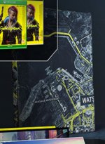
But on the map Kubaki is labled on the other side of that canal. So ... ? I get that Metro maps are not to scale, but you would think an entire sub-district would be on the correct side of a body of water.Some guy on reddit compared the driving segment to the map and its fairly accurate, and at the very end you can see "entering Little China" so the very japanese-y area V was driving in is surely Kabuki
also in the fist fighting mission, it tells you to meet the twins in Kabuki, where you can see that area across the river
at this point, i find it hard to believe that CDPR made a sub district occupies both sides of the river, especially after having that complete look of NC concept art
1. A line represents 12 seconds (about 90~100 per hour)
2. From the northernmost side (A) to the southernmost side (B), 64 lines (768 seconds) are used, so the map can be
crossed in about 12 minutes
So that's ~ 21,84km or ~ 13,34 miles.
100km/h is 27,78m/s times 786 s is 21 835 meters or 21,84 km.
I messed up. The car is going 100 mph not 100 km/h.
So the calculation comes to 44,7 m/s. Which makes it 35 km!

I messed up. The car is going 100 mph not 100 km/h.
So the calculation comes to 44,7 m/s. Which makes it 35 km!