

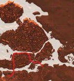
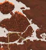
Geralt's approximate trajectory in 35 min. demo.
Correct me if I'm wrong.
Correct me if I'm wrong.
Attachments
-
 9xKOqrD.jpg72.9 KB · Views: 44
Last edited:
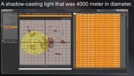
Yep, we've known for quite some time that Skellige map is 8x8km and I estimated the NE-SW diameter of Ard Skellig to be ~2.4 km based on the stepmeter in January demo.Also from the same GDC presentation as above we now have some solid numbers on the scale of the Skellige map:

That is, the main island is now confirmed to be approx. 2x3km.
Should be fine now.Your image is broken for me.
Geralt's approximate trajectory in 35 min. demo.
Correct me if I'm wrong.

Your image is broken for me.
Logically, the sewers should lie beneath the 'oldest' section of the city, and not the outskirts.
And under the rich district
North side of The Mire there's an island, can't get the name but looks interesting, anyone with depth lore knowledge can open my eyes about it?

Great map. But Oxenfurt looks quite different here. It consist of only one island in all other images we have seen not two like here.I found this map world map, apparently it's a pre order bonus.

I found this map world map, apparently it's a pre order bonus.

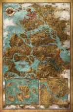
It's from Prima's strategy guide